
Mt. Agung Erupts and Rumbling Sounds Heard up to Rendang Post
Resiani - atnews
Karangasem, 31/5 (Atnews)–
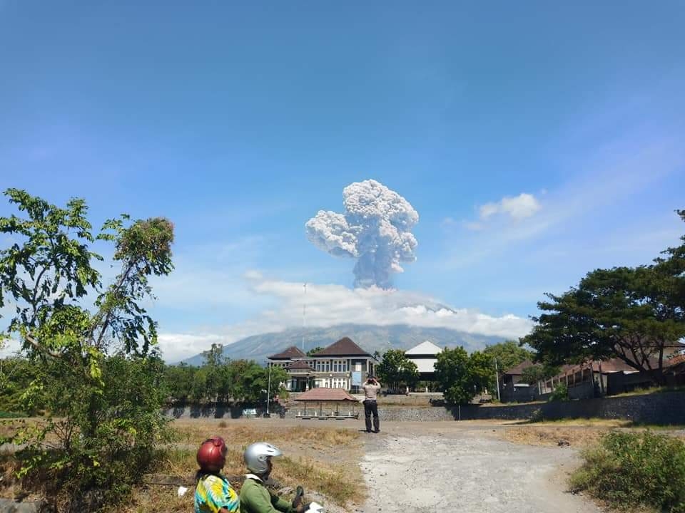
Mount Agung, Bali, returned to erupt on May 31, 2019 at 11:42 local time with the height of the ash column observed at ± 2,000 meters above the peak (± 5,142 meters above sea level), as reported by Ministry of Energy and Mineral Resources, Geology Agency, Mount Agung PVMBG Observation Post, Friday.
The ash column was observed to be gray with thick intensity leaning northeastward and eastward. The eruption was recorded on a seismogram with maximum amplitude of 30 mm and duration of ± 8 minutes 4 seconds and there was a roar heard up to the Rendang Post.
At present, the alert level of Mount Agung is in Level III (Advisory) with recommendations as follows:
1) Communities around Mount Agung and climbers or visitors or tourists are recommended not to be, not to climb and not to carry out any activities in the Hazard Estimated Zone, namely in all areas within a 4-km radius of the crater of Mount Agung. The Estimated Hazard Zone is dynamic and continues to be evaluated and can be changed at any time to follow the latest or most up-to-date observation data of Mount Agung.
2) Communities residing and moving around the river flows with the upstream at Mount Agung should be aware of the potential secondary hazard in the form of rain lava flows that can occur especially during the rainy season and if the eruption material is still exposed in the peak area. The land area of the rain lava follows the rivers with the upstream in Mount Agung. (*/ika)

Baca Artikel Menarik Lainnya : Populasi Perempuan Bali 40 persen, PKK Perlu Program Tepat Sasaran


